
Drain the Swamp: The Definitive Account
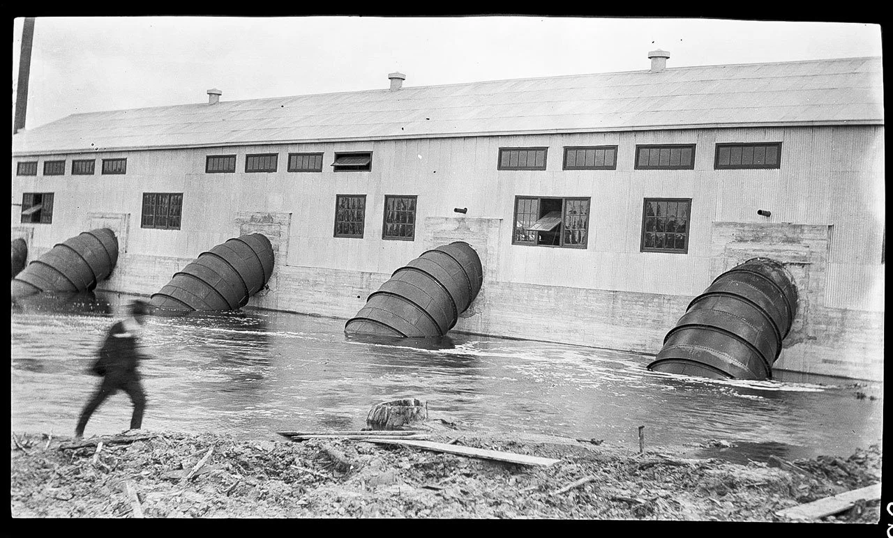
Flood at a pumping station, circa 1900 - 1925, photograph by Reginald McClure Smith, courtesy The Historic New Orleans Collection
October 2023A new book by Richard Campanella details the soggy saga of a city built on a deltaic plain, sandwiched between the continent’s largest river on one side and a 1.5 trillion-gallon lake on the other.
– by John S. Sledge
The summer after Hurricane Katrina, my wife and I visited the slowly recovering New Orleans French Quarter. We had the streets largely to ourselves and the pick of any table at any restaurant. While this made for a relaxed, hassle-free experience, we knew it wasn’t good for a city so heavily dependent on tourism.
In an effort to better understand the storm’s impact, we joined a three-hour “Katrina Tour” and boarded the minibus near Jax Brewery under lowering skies. We had barely got underway before the heavens opened and the rain poured, streaking and smearing our view. The coliseum, the Superdome, and the London Avenue Canal all looked ordinary and forlorn through the deluge. The Lower Ninth Ward was off limits due to concerns about insensitive disaster tourism, but Lakeview was not. As our minibus passed the blocks of deserted houses with their painted X Codes, we came to a deeper appreciation for New Orleans’ vulnerability. The rain lashing our minivan and sluicing alongside only reinforced the realization.
New Orleans has always presented daunting challenges as a place to live, precariously positioned as it is on a deltaic plain, sandwiched between the continent’s largest river on one side and a 1.5 trillion-gallon lake on the other. Add a subtropical climate defined by high heat, humidity, and abundant rainfall, and the wonder is that the city has survived as long as it has. Indeed, as Katrina so powerfully demonstrated, New Orleans’ very existence depends on managing floodwater and managing it well. The consequences, otherwise, as we saw on our short tour, are devastating.

Flood Street flooded by Hurricane Betsy, 1965, by G.E. Arnold. Courtesy The Historic New Orleans Collection
Richard Campanella, geographer and associate dean for research at the Tulane School of Architecture, understands these consequences well. As the author of 14 books and over 200 articles about Louisiana history and geography, he can explain why the city is where it is, how it evolved despite its many challenges, and who the colorful personalities were who met those challenges. In his latest effort, Draining New Orleans: The 300-Year Quest to Dewater the Crescent City (LSU Press, $39.95), he thoroughly explores the fascinating and complex story of New Orleanians’ attempt to master their aqueous environment. It is a topic, he assures the reader, that “has undergirded the content of nearly all my previous books and articles about the geography of New Orleans.”
The narrative unfolds chronologically, the first three chapters covering from antediluvian times to 1850. Thereafter it advances by one-, two-, or three-decade increments. Campanella has seemingly read everything ever written about this subject, from colonial correspondence to 19th-century Drainage Advisory Board reports, modern bureaucratic master plans, and countless newspaper stories—over 150 for 1886 alone. Sensibly, New Orleanians have long obsessed over drainage.

Click on the cover to purchase from your favorite Indie bookstore

Richard Campanella, photo by Marina Campanella, courtesy LSU Press
The region’s original Indian inhabitants did not concern themselves with it, however. They used the future townsite as a handy portage to Lake Pontchartrain and erected simple dwellings along the riverbank’s natural levee, the so-called “Sliver by the River,” to exploit nearby resources. When floodwaters threatened, they simply decamped to higher ground until conditions improved. Once the French founded a permanent town in 1718, though, excess water needed removal, and that meant engineering. King Louis XV ordered the colonists to “dig little ditches in front of their houses.”
These took advantage of the slight elevation to help drain off rainfall, with mixed results. Not all landowners were diligent—some were absentee—and neglected ditches silted up or filled with oyster shells and rubbish. Standing water, foul air, and clouds of mosquitoes were common, as were devastating epidemics. Visitors to the struggling muggy outpost were unimpressed. In a spectacularly negative rhetorical flourish one branded the city a “boiling fountain of death [,] dismal, low and horrid [,] belching up its poison and malaria [,] feeding the living mass of human beings [with] the dregs of the seven vials of wrath.”
Campanella does a good job of informing the reader how locals adapted their lexicon to this townscape. The French referred to city blocks as Îles, or islands, which, he writes, “in a place called the Île d’Orléans is to limn the omnipresence of water in this terre d’alluvion.” As late as 1900, “the local vernacular retained two old Creole words reflecting this urban microtopography; islets, meaning city squares, and banquettes, meaning either raised wooden walkways (‘little benches’) or the diminutive for the banks (banques) of a river.” Language wasn’t the only thing affected by the environment. Building changed too. Settlers raised homes on brick piers several feet above the muck, wrapped open galleries around stuccoed half-timber walls with multiple tall doors and windows, and capped them by double-pitched hip roofs to throw off the rain.

An 1890 map of New Orleans included in the book. Compare to the current flood map of the city below. Courtesy LSU Press.

A contemporary map of New Orleans. Areas now below sea level are in red. Courtesy LSU Press
By the mid-19th century, which Campanella calls the “polder and paddle era,” large “machines powered by steam siphoned swamp water by the thousands of gallons and pushed it into Bayou St. John using wooden paddle wheels.” Locals had also become better at administering drainage efforts, having evolved from reactive measures to a more efficient system of “top-down political engagement of commissions, boards, and engineering companies.”
Throughout the 19th and early 20th centuries, dewatering the city came under the purview of “Drainage Kings,” larger-than-life personalities who were part engineer, part politician, and sometimes part huckster. Among the latter was “Colonel” George F. Brott, “a born speculator and an ideal promotor [with] restless eyes, a sanguine disposition, winning ways, and a volubility which has seldom been equaled.” Brott wanted to slice through the city with a 35-mile-long “sea-way,” 300 feet wide and 25 feet deep, to connect the Mississippi River to Lake Borgne, making New Orleans an easily accessible interior port. The full plan remained unrealized. But Brott’s idea to provide three outfall canals through Lakeview and Gentilly was, and these ditches hampered engineers for decades. Katrina breached two of them. According to Campanella, “Brott’s folly” provides a classic example of “path dependency,” i.e., a situation where previous bad decisions “steer future decisions in bad directions.” New Orleans’ drainage history is replete with such examples.

Magazine illustration showing boats and stranded people on Canal Street in the 1871 Flood. Courtesy The New Historic New Orleans Collection
George Alfred Hero was a far more effective drainage king than Brott. This “dapper polymath” employed the massive “low-head, high-volume axial-flow twelve-foot centrifugal screw-pump" to remove a million gallons a minute to completely dewater the West Bank. In grand New Orleans fashion, he achieved this on February 13, 1915--”Hero Day”--just before Mardi Gras. Hero led a parade of local politicians, businessmen, and society elites complete with marching bands and heralds down to the river where they boarded a boat for Bayou Barataria and the “ragged backswamp.”
After everyone had assembled around the big pumps, President Woodrow Wilson started the motors with a button in the White House “connected via telephony to the banks of Bayou Barataria.” It worked splendidly, and swamp land theretofore valued at $3 an acre skyrocketed to $200-$500 almost instantly. Thanks to Hero, a vast swamp became a living neighborhood.

A political cartoon included in the book of President Woodrow Wilson pushing the button to activate Louisiana pumps. Courtesy LSU Press
Unfortunately, the downside to so thoroughly draining swamp land is that, deprived of its water volume, the land sinks. Hence New Orleans’ great irony: just about everybody believes the city is below sea level and always has been, when in reality human engineering sank it! In an attractive color plate gather, Campanella contrasts city maps circa 1890 and today to demonstrate this. In 1890, most of the landscape was above sea level, albeit not by much, whereas thanks to successful drainage efforts like Hero’s, parts of it are now four to eight feet below sea level.
Campanella concludes his book with an overview of the “Dutch Dialogues.” This exchange advocated a wiser approach to water management. During the post-Katrina years, politicians, planners, architects, and engineers made several trips to the Netherlands to study how the Dutch expertly handle drainage and storm surge. A series of back-and-forth visits and charettes encouraged an approach that “let gravity and nature do the routine work.”
Among the specific recommendations: use permeable surfaces for parking lots and driveways rather than pavement that worsens runoff; build retention ponds to hold rainfall rather than letting it inundate city streets; lay bigger underground pipes to carry more volume; and plant trees and greenways to hold water as well as please the eye. While there are sceptics, including the U.S. Corps of Engineers, these ideas are being implemented piecemeal. If this course is maintained, Campanella assures the reader, it will result in a more livable and attractive city.
Draining New Orleans would benefit from more and better maps to help those lacking a thorough knowledge of the city’s geography, neighborhoods, and street grid. But Campanella is a supremely knowledgeable and entertaining guide with a facile pen, and anyone desiring a profound understanding of the Crescent City’s “aquatique problem” need look no further than this volume.
Love our French Quarter coverage?
We can't do it without you!
Become a member of our Readers’ Circle now: